
Champadevi is the hill the Kathmandu Valley forgot. Nagarkot gets the hotels, Shivapuri gets the national park, Chandragiri got a cable car, and the south-west rim's highest walkable point gets a footpath, a small shrine, and a view that takes in the whole valley on one side and the Himalaya on the other. It is also the hike where the published numbers disagree most, so the start points, hours, altitude, and add-ons below are settled against the sources.
The route at a glance
| Stage | From and to | Altitude at end | Hours | Notes |
|---|---|---|---|---|
| Drive | Thamel to Hattiban (above Pharping) | ~1,750 m | 0.75-1 | Taxi or ride-hail; buses stop in Pharping bazaar |
| 1 | Hattiban to the ridge saddle | ~2,050 m | 1-1.25 | Pine and oak forest, stone steps in places |
| 2 | Saddle to Champadevi summit | ~2,280 m | 1-1.25 | Open ridge, the views start |
| Optional | Summit to Bhasmasur | ~2,600 m | 1-1.5 each way | Rougher trail, add 2-3 hours total |
| 3 | Summit down to Pharping bazaar | ~1,450 m | 1.5-2 | Steeper, through terraces and village lanes |
| Drive | Pharping to Thamel | 1,400 m | 0.75-1 | Buses to Balkhu, or your waiting taxi |
Figures vary by source because the summit has been measured at anything from 2,241 m to 2,285 m, and because "Champadevi" on a tour brochure may mean the shrine, the ridge beyond it, or the full traverse. The table is the shrine via Hattiban, which is the version most people walk.
Stage 1 and 2: Hattiban to the shrine
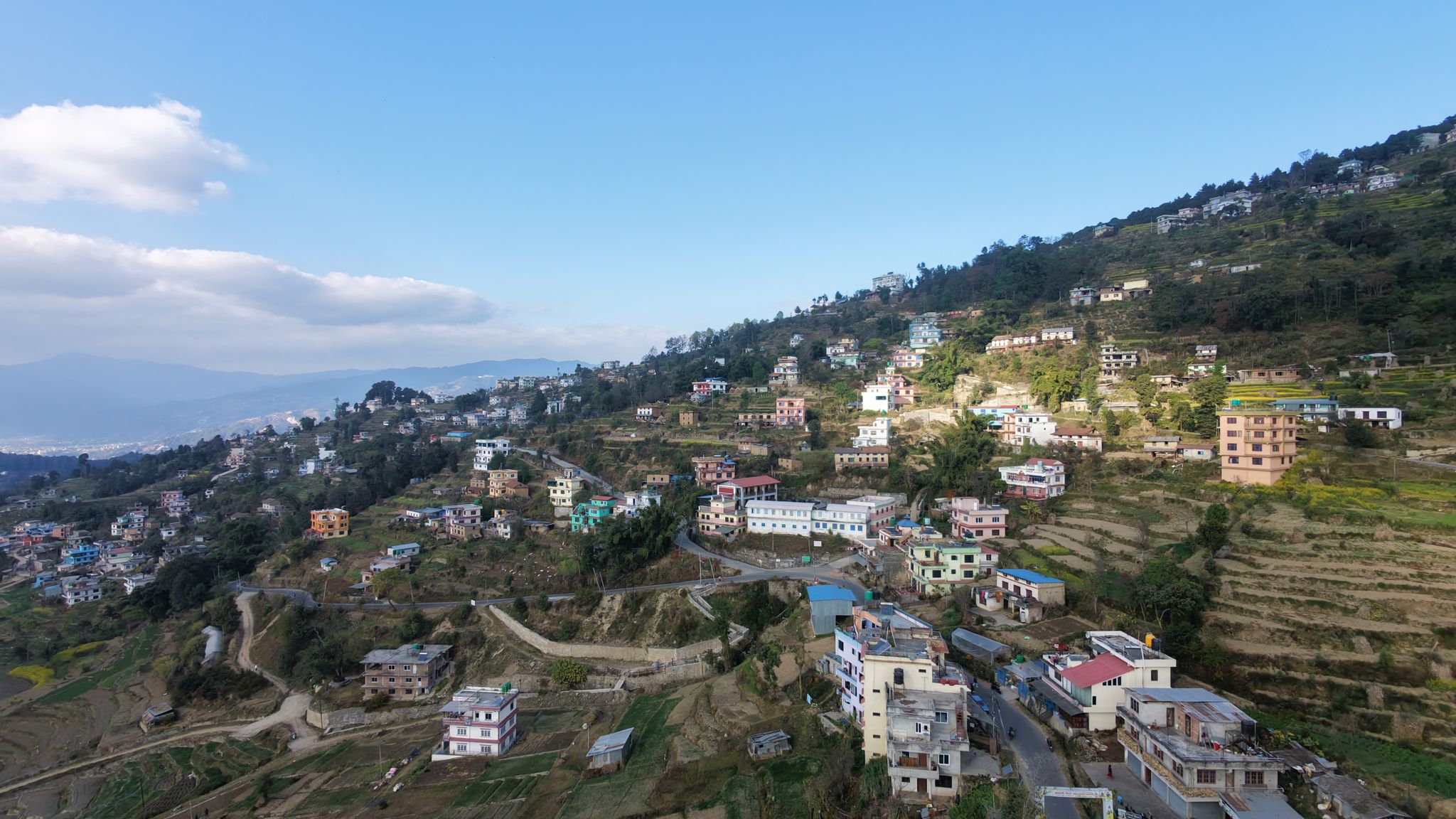
The trail leaves the road just above the Hattiban resort gate, where a signboard and a cluster of parked motorbikes mark the start, and climbs through planted pine that gives way to oak and rhododendron higher up. The grade is steady rather than brutal, with stone steps on the steeper pitches, and the forest keeps you shaded for the first hour. At the saddle the trees thin, the ridge opens, and the valley appears below you all at once: Pharping's monasteries on their spurs, the Bagmati's gorge, and the whole bowl of Kathmandu spread north to the far rim.
 The south-west rim's view, here from Chandragiri next door: the valley floor, the far rim, and on a clear morning the Himalaya behind it
The second hour follows the ridge, with short ups and downs, to the summit, where a small shrine to Champa Devi sits among prayer flags and a few benches. On clear mornings from October to February the Langtang range, Ganesh Himal, and Gauri Shankar stand along the northern horizon; by 10 am the haze usually swallows them, which is the whole argument for an early start.
The Champadevi trail from the Hattiban start to the summit shrine (Infinite With Nishan)The Bhasmasur ridge, and the traverse
Beyond the shrine the ridge continues west and up to Bhasmasur, around 2,600 m, a rougher hour to an hour and a half each way with more exposure to sun and better mountain views. Most day hikers turn around at Champadevi; Bhasmasur is for people who want a full day and have water for it.
The long version is the Chandragiri to Champadevi traverse: ride the Chandragiri cable car up, walk the rim west past Bhasmasur to the shrine, and descend to Pharping. Six to eight hours, with an early start non-negotiable. The hiking in Nepal guide compares it with the other valley-rim walks.
 The valley rim in winter light: terraces, haze in the bowl below, and the white line of the Himalaya that rewards anyone up before nine
Stage 3: down to Pharping
The descent to Pharping bazaar is steeper than the climb, through terraces and the lanes of a village that has been a Buddhist pilgrimage town for a thousand years. Budget the leftover energy for Pharping itself: the Vajrayogini temple, the Asura cave where Padmasambhava is said to have meditated, and the hillside monasteries covered in our Buddhism in Nepal guide. Dakshinkali, the valley's best-known sacrifice temple, is a short drive further and busiest on Tuesday and Saturday mornings.
Getting there, fees, and timing
A taxi or ride-hailing car from Thamel to the Hattiban turn-off takes 45-60 minutes and costs roughly NPR 1,500-2,500 one way; verify current fares, and arrange the pickup in Pharping rather than Hattiban so you can walk the loop. Local buses to Pharping and Dakshinkali leave from Balkhu, take about an hour, and are the cheap option on the way back. Our day trips from Kathmandu guide covers the same corner of the valley by car.
There is no park fee. Champadevi sits outside Shivapuri Nagarjun National Park, so the daily permit and the nature-guide requirement on the northern rim do not apply; a resort or landowner at the start may ask for a small parking or trail charge. Carry two litres of water per person, since there are no shops between Hattiban and Pharping, and a hat, since the ridge has no shade after the saddle.
Best months: October to February for the mountain view, with December and January the clearest and the coldest at the top. March is warm and hazy; the monsoon turns the path to mud and the view to cloud. Start by 7 am in any season. Two things that have caught walkers on the valley rim: the ridge has side paths that drop into the wrong valley, so stay on the crest and on the main trail, and phone signal is patchy, so tell someone your plan.
Champadevi is the half day this site recommends to anyone staying in Kathmandu with a clear morning to spend. For the overnight version of a rim walk, the Nagarkot to Dhulikhel hike is the next step up, and the sunrise viewpoints guide covers where else the Himalaya shows itself from the valley's edge.