Most people picture walking in Nepal as two weeks on a trail to a base camp. A lot of the best of it starts from a bus stop on the edge of Kathmandu or a boat jetty on Phewa Lake and is over by mid-afternoon. Hiking in Nepal, in the sense of a day walk or a single night out with a daypack, puts you on the rim of the Kathmandu Valley or the ridges above Pokhara with the Himalaya on the horizon, and spares you the flights and altitude of a full trek. This guide compares 13 of those hikes, then covers fees, the park guide rule, transport, and staying safe.
Hiking vs trekking in Nepal
In Nepal, trekking means a multi-day walk from lodge to lodge, and it has its own guide: trekking in Nepal. Hiking, as people in Kathmandu use the word, is shorter. It's a day on the valley's hills, or one night in a hilltop village for the sunrise, carrying a daypack and eating at a tea shop or from your own lunch box.
Most of these hikes stay between 1,500 and 2,800 m. That is high enough for the views and low enough that altitude sickness isn't a concern, with Kalinchowk at 3,842 m the one exception.
The best day hikes compared
Times are walking times at a steady pace from the trailhead. Fees are for foreign visitors and change often, so check them on the day.
| Hike | Start | Walking time | High point | Difficulty | Fees and rules |
|---|---|---|---|---|---|
| Shivapuri summit | Budhanilkantha (Panimuhan gate) | 5-6 hours return, some estimates 8+ | 2,732 m | Hard | Park fee NPR 1,000; nature guide required |
| Jamacho (Nagarjun) | Phulbari gate, Balaju | 3-4 hours up, 2 down | ~2,100 m | Moderate | Park fee NPR 1,000; nature guide required |
| Champadevi | Pharping | 2 hours up, 2 down | ~2,250 m | Moderate | No park fee we could confirm |
| Phulchoki | Godawari | 3.5-4 hours up; a full day | 2,782 m | Hard | No tea shops above Godawari |
| Nagarkot to Dhulikhel | Nagarkot | 4-7 hours one way | ~2,175 m down to 1,550 m | Moderate, mostly downhill | None |
| Dhulikhel to Namobuddha | Dhulikhel | About 3 hours one way | 1,750 m | Easy to moderate | None |
| Sundarijal to Chisapani to Nagarkot | Sundarijal | 2 days, 5-7 hours each | 2,427 m (Borlang Bhanjyang) | Moderate to hard | Park fee NPR 1,000 at Sundarijal |
| Chandragiri | Thankot | About 4 hours up, or the cable car | 2,551 m | Hard on foot | Cable car about USD 22 return |
| Australian Camp and Dhampus | Kande or Phedi, near Pokhara | 1.5-2 hours up; 5-6 hour loop | ~2,060 m | Easy to moderate | ACAP permit, NPR 3,000 |
| Sarangkot | Lakeside, Pokhara | 1.5-2 hours up | ~1,600 m | Moderate | Cable car alternative |
| World Peace Pagoda | Boat across Phewa Lake | 45-60 minutes up | ~1,100 m | Easy to moderate | Pagoda free; boat about NPR 800 one way |
| Kalinchowk | Kuri, Dolakha | 30-90 minutes to the temple | 3,842 m | Moderate (altitude) | Cable car option |
| Thani Mai and Siddha Gufa | Bandipur bazaar | 30 minutes to 1.5 hours | ~1,000-1,300 m | Easy | Small cave entry and guide fees |
Kathmandu Valley rim hikes
The valley is a bowl ringed by forested hills, and almost every hike here climbs to that rim for the view north to the Langtang and Ganesh Himal ranges.
Shivapuri is the big one: the highest point on the northern rim at 2,732 m, inside Shivapuri Nagarjun National Park, reached by a steep forest climb from Budhanilkantha that passes the Nagi Gompa nunnery on the way up. If five or six hours of climbing is more than you want, Nagi Gompa alone is a 1.5-2 hour return walk and still gets you above the city's dust. Jamacho, on Nagarjun hill to the west, is the shorter sibling: three or four hours up through the same park to a stupa and a viewing tower.
Champadevi, on the south-west rim, is the best half day. Two hours up from Pharping brings you to a small temple and a long ridge view, and Pharping's cave shrines, covered in day trips from Kathmandu, fill the rest of the afternoon. Phulchoki, above Godawari, is the opposite: the valley's highest point at 2,782 m, a long climb with no tea shops, and the forest birdwatchers rate most highly.
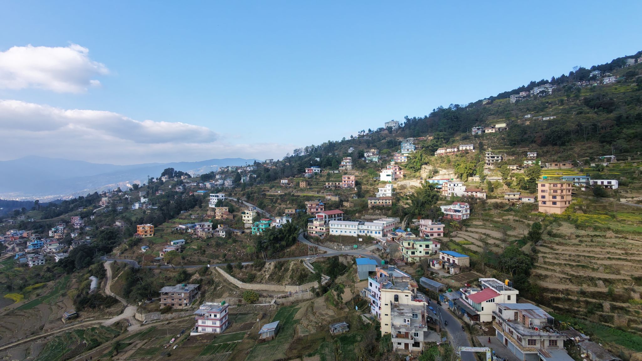
 Terraces and forest edge on the valley rim: most Kathmandu hikes look like this, on footpaths between villages
The east side is gentler. Nagarkot to Dhulikhel is the walk most visitors should do first. Sleep in Nagarkot for the sunrise (our sunrise viewpoints guide compares it with Sarangkot), then walk downhill through pine forest and terraced farms for four to seven hours; the Nagarkot to Dhulikhel hike guide has the route. From Dhulikhel, a well-signed path continues about three hours to the monastery at Namobuddha. In the south-west, Chandragiri has a cable car to the summit temple, which turns it into an easy morning for anyone who doesn't want the four-hour climb.
Day hikes from Pokhara
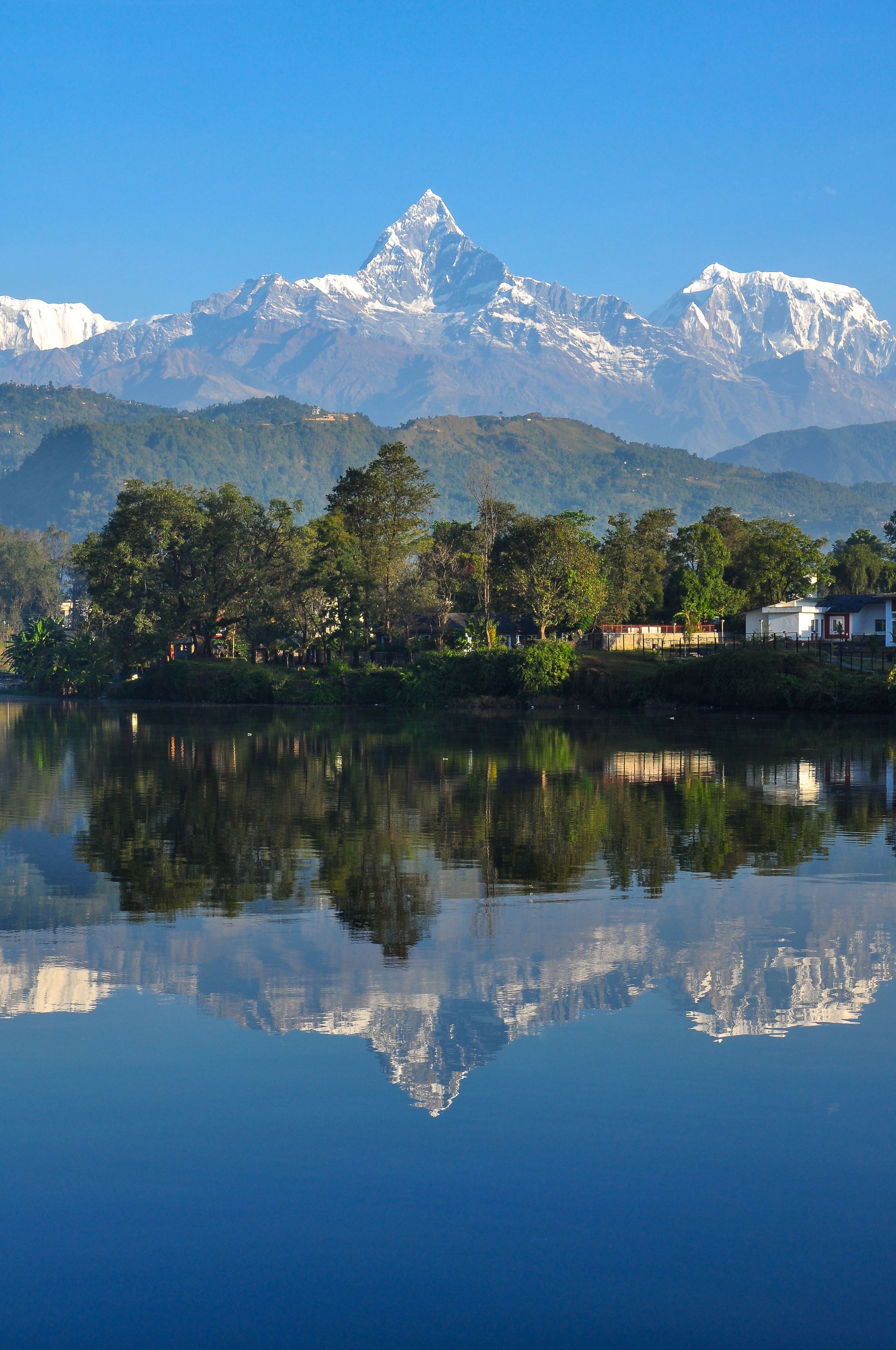
Pokhara's hills put bigger mountains in the frame, because Machhapuchhre and the Annapurnas rise straight behind the lake.
Australian Camp and Dhampus is the classic. A 45-60 minute drive takes you to Kande. From there a 1.5-2 hour climb reaches a grassy ridge at about 2,060 m with Machhapuchhre straight ahead, and the path loops down through the village of Dhampus to Phedi. It lies inside the Annapurna Conservation Area, so you need the ACAP permit (NPR 3,000). Checks at Kande are reportedly rare, but carry it anyway, and buy it in Pokhara because checkpoints charge double. Many people stay the night up there for the dawn.
Sarangkot is the hill directly above Lakeside, 1.5-2 hours on foot or a few minutes by cable car, and Pokhara's standard sunrise point. Strong walkers carry on west along the ridge to Naudanda, mostly downhill.
 The World Peace Pagoda, 45-60 minutes uphill from the Phewa Lake boat landing
The World Peace Pagoda is the easiest of the three. A boat across Phewa Lake takes about 15 minutes (around NPR 800 one way in early 2026). From the landing, the climb through forest to the white stupa takes 45-60 minutes, and the walk down to Damside lands you on the lakeshore for the evening light.
Hiking in the Kathmandu Valley, old and new routes (FromEverest)Further afield: Kalinchowk, Bandipur, Ilam
Kalinchowk is the winter trip. After a 4-6 hour drive east to Kuri in Dolakha, you walk 30-90 minutes (or take the cable car) up to the Kalinchowk Bhagwati temple at 3,842 m. The first snowfall sends crowds up from Kathmandu, and the altitude is real enough to take slowly; Nepal in winter covers the snow season.
Bandipur, the hill town between Kathmandu and Pokhara, has two short walks: 30 minutes up to Thani Mai for sunrise, and about 1.5 hours to the Siddha Gufa cave, where the ladders are slippery and you pay a small entry fee plus a local guide. In the far east, Ilam's tea country is walking among tea bushes, with Antu Danda (2,328 m) the sunrise point for Kanchenjunga.
When a day isn't enough
The walk from Sundarijal over Borlang Bhanjyang to Chisapani and on to Nagarkot is the bridge between hiking and trekking: two days with a night in a simple Chisapani lodge. The park fee is paid at the army post in Sundarijal. Carry water for the long dry stretch from Mulkharka to Chisapani. West of Pokhara, the three-day Panchase ridge reaches about 2,500 m through forest.
Beyond that you are trekking. Poon Hill and Mardi Himal are the shortest real treks, four or five days each from Pokhara; the trekking guide's comparison table sets them against the longer routes.
Fees, permits, and the guide question
Shivapuri Nagarjun National Park covers Shivapuri, Nagi Gompa, Jamacho, and the Sundarijal to Chisapani trail. Its official fees page lists NPR 1,000 per person per day for foreigners and NPR 600 for SAARC nationals, and makes a nature guide mandatory for both. The park also bans meat and alcohol and expects you out by sunset. One 2025 trip report paid about NPR 1,000 for a guide for the whole group on the Nagi Gompa walk.
Outside the park, the valley hikes at Champadevi, Nagarkot, Dhulikhel, Namobuddha, and Chandragiri have no entry fee or guide rule that we could find. Around Pokhara, Australian Camp and Dhampus fall in the Annapurna Conservation Area and need the ACAP permit; Sarangkot and the Peace Pagoda need nothing. The TIMS card is a trekking document and the valley day hikes don't need one; if you plan to sleep at Australian Camp or Dhampus, ask whoever sells your ACAP permit whether TIMS applies. The trekking permits guide covers the multi-day routes.
Getting to the trailheads
Taxis and ride-hailing apps are the easy way to reach the valley trailheads. Budhanilkantha, Phulbari, Pharping, and Godawari are each around an hour from Thamel outside rush hour. Nagarkot takes 1.5-2 hours, Kuri for Kalinchowk a long half day. Local buses from Ratna Park reach Sundarijal and Budhanilkantha for a fraction of the price, slowly. In Pokhara a taxi to Kande takes 45-60 minutes, and the Peace Pagoda boats leave from Lakeside.
On a one-way walk like Nagarkot to Dhulikhel, sort out the ride home before you set off, or plan to catch the bus from the finish.
When to go and staying safe
October and November give the clearest views. March and April bring rhododendron to Shivapuri and Phulchoki, with more haze by midday. December to February is cold and crisp in the mornings and the season for snow at Kalinchowk. From June to September, expect mud and leeches, with the peaks hidden in cloud.
The forests on the rim are thicker than they look from the city, and people get lost in them. In December 2024, 13 hikers lost their way on Phulchoki and called the police; in August 2024, three visitors spent about ten hours lost in the Nagarkot forest before rescue. Start early, carry an offline map and a charged phone, tell your hotel where you're going, and don't walk the forest sections alone. Carry at least two litres of water and some cash. The Tourist Police number is 1144.
If you only have one free day in Kathmandu, take the bus or a taxi to Nagarkot the evening before, wake for the sunrise, and walk down to Dhulikhel. In Pokhara, row across to the Peace Pagoda in the late afternoon and walk back along the lake as the light goes.